Photo By: Kevin Morgan
 

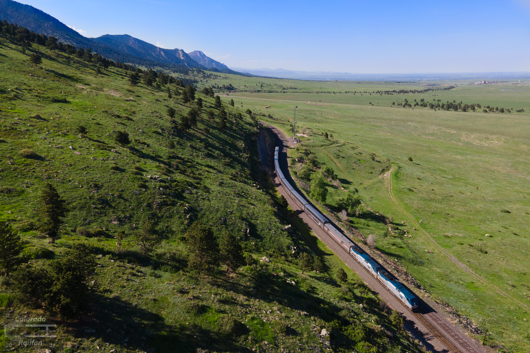
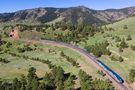
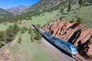
The eastbound Zephyr rolls east on the main at Eisele as it continues the journey east toward Denver and points beyond. Eisele is really the last place the eastbound Zephyr will skirt the front range of the Rockies before leaving the mountains behind after descending down from Big Ten Curve ahead. The siding was originally called Fire Clay, due to the red clay rock found in the area. When Rio Grande shortened many siding names on the system, it was shorten to just Clay. Then, just over eight years ago, on April 2, 2013, UP changed the name from Clay to Eisele in honor of Charley Eisele, a UP official that retired.
Email Questions or Comments to the Webmaster.
User Comments (0)

No comments posted yet. Click Here to add the first one!

593
views
0
comments
Thursday, June 3, 2021 at 5:07:18 PM
image date


Location Information
City or County and State
Arvada, CO

Subdivision
Moffat Tunnel (UP)

Milepost or Control Point
Eisele (Clay) (5,780 ft)


Train Information
Railroad
Amtrak
Model
P42DC
Unit Number
AMTK 197

Symbol
AMT6-02
Paint Scheme  


Photo Information
Camera Make/Model
DJI / Mavic Air 2 [FC3170]
ISO
100
Flash
Did Not Fire

Focal Length
24 mm
Shutter
1/500 seconds
Aperture
f/2.8


Check out ColoradoRailfan.com on Facebook
Check out the latest ColoradoRailfan.com photos on Flickr

ColoradoRailfan.com Email Subscription
To receive updates made to ColoradoRailfan.com via Email, Click Here.

The D&RGW Site Ring
This site owned by: Kevin Morgan
Add Your Site

SiteRing by Bravenet.com

SiteRing by Bravenet.com

All content ©2000,2024 by Kevin Morgan, except where noted. Please do not use any material from this site without permission. Thank You.