The Siding Of
Rocky
| West to Clay |
The Siding Gallery, by design, does not show any trains (unless it is unavoidable) in pictures of the sidings. This is so you can see the layout of the land and get your own ideas on how to take pictures of trains. However, if you'd like to see pictures taken from various spots at this siding, then you can Search the Photo Gallery for pictures here on ColoradoRailfan.com!
The Siding of Rocky is located at milepost 18.0 and is the second siding westof Denver. It is also the longest (until Rollins) at 7,330 feet, although, like Leyden,it was once drastically shorter. And, like Leyden, it was extended to the west toaccomodate the longer trains of a higher-horsepower era.
The east end of Rocky is accessible via CO Highway 93. When heading southbound onCO 93 from CO 72, you will pass over some tracks that are protected by a stoplight.This is the Rocky Flat Spur that branches off of Rocky. Shortly afterward, you willpass over the track on a (new) bridge. Directly after the bridge there is aturnoff to the right. This lead down a short dirt road to the east end of Rocky. Thewest end of Rocky is not readily accessible by car.
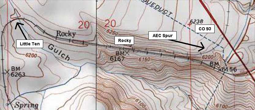
Here is the topographical representation of the area of Rocky. Although it is notshown in the map, the west end of Rocky has been extended all the way around LittleTen and part of the way up toward Big Ten.
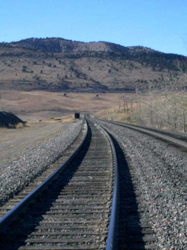
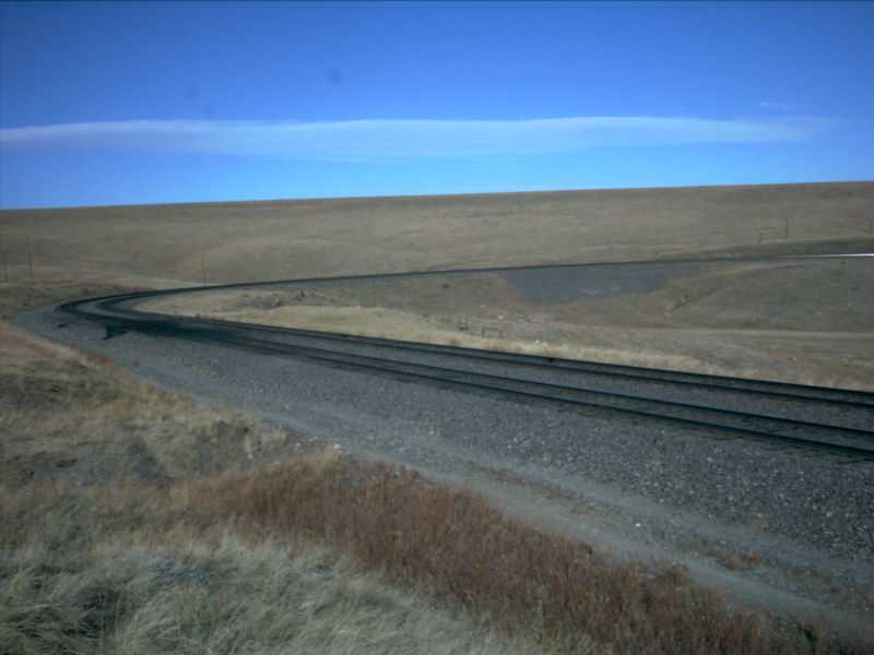
Picture 1
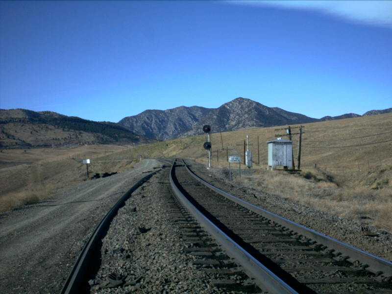
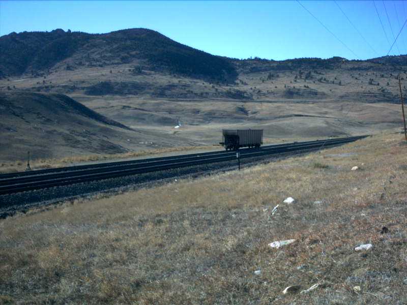
When entering Rocky heading west, if you were to continue in a straight line overthe hill, you would end up almost directly at the mouth of Coal Creek Canyon. The tracksdo eventually end up there, but not quite in a straight line. In this picture, you cansee the east end of Rocky. Notice the white sign to the right of the tracks. Thisindicates to the crew that a channel change is needed. In this case, the dispatcheralso changes from UP 86 to UP 82. Trains are under Dispatch 82s jurisdiction now allthe way to Dotsero. If you're interested in finding this particular spot, tune yourGPS locaters to these coordinates:
Latitude: 39º51.553'N
Longitude: 105º14.224'W
Elevation: 6125 feet
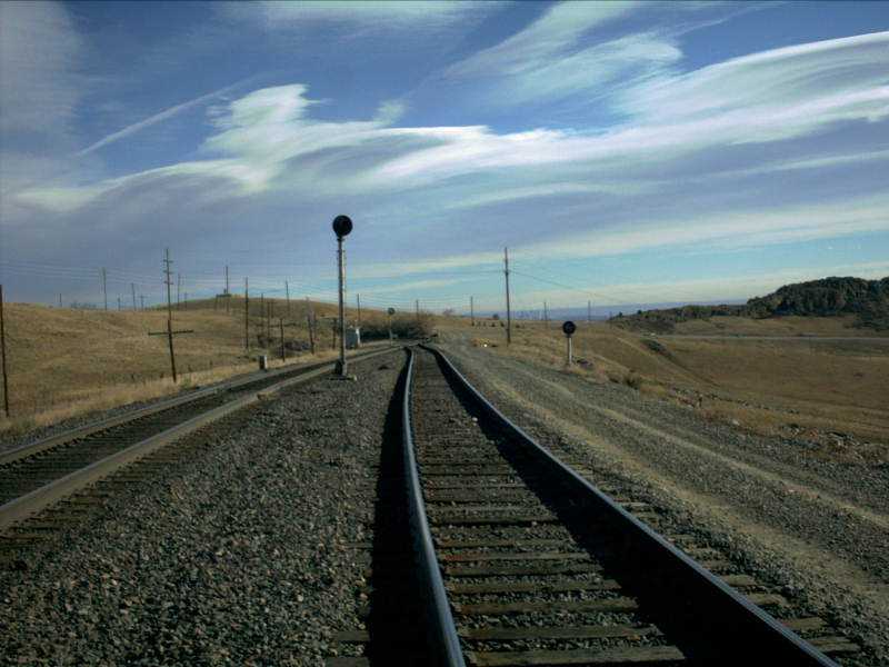
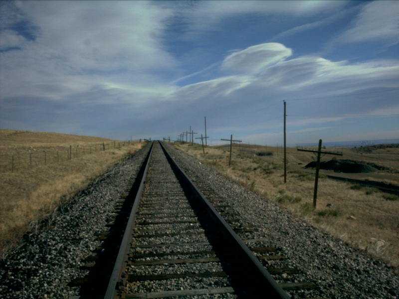
Picture 2
In this picture looking east, you can see the railroad access road to the right(south) side of the tracks. Although it does not stand out especially in this picture,if you look closely, you can see downtown Denver just to the right of telephone pole,between the two block signals. Colorado Highway 93 runs north / south off to the rightof the picture.
Just like at Leyden, Rocky is also used as a temporary storage place fortrains from time to time. Either when North Yard is full, or when a crew "dies" (hasbeen working a train long enough to be required to stop and disembark from the train)and the train must wait for awhile before getting a relief crew. Also as at Leyden,a derail switch was installed at Rocky to save crews time. When a train is tied downon the siding, the switch (which has a very large padlock on it!) need onlybe set and any cars that roll to the east end will derail and avoid block the mainline.
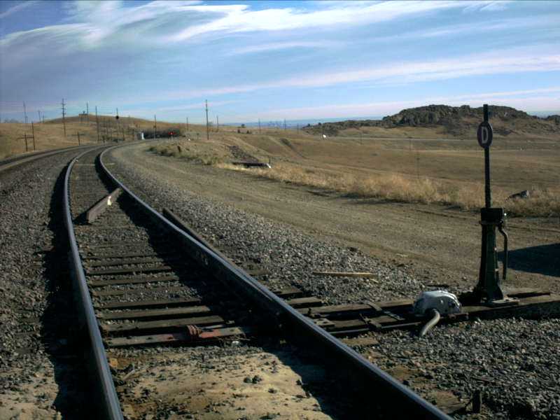
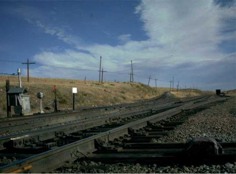
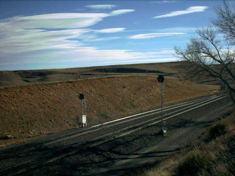
Picture 3
Here is a very good picture of the derail switch at Rocky. Certainly looks somewhatodd only having a point on one of the two rails, and this derail would clearly do itsjob if it were required to! Notice the rail in the middle of the siding at an angle(roughly 45 degrees) to the rails of the siding. This is used to try to help push thecars that have derailed away from the mainline and out of harms way. Also notice thedwarf signal on the siding indicating red and the signal on the mainline off. There arenot currently any trains in the area, but the mainline signal is approach lit whereasthe drawf is not.
Picture 4
As soon as you get around the first curve at the east end of the siding, there isa nice length of straight track heading back toward Little Ten curve. It is along thisstretch of track that the house track and the Rocky Flats Industrial Lead Spur arelocated. You can also very clearly see a change in grade as you get toward the westend of the straight section of track.
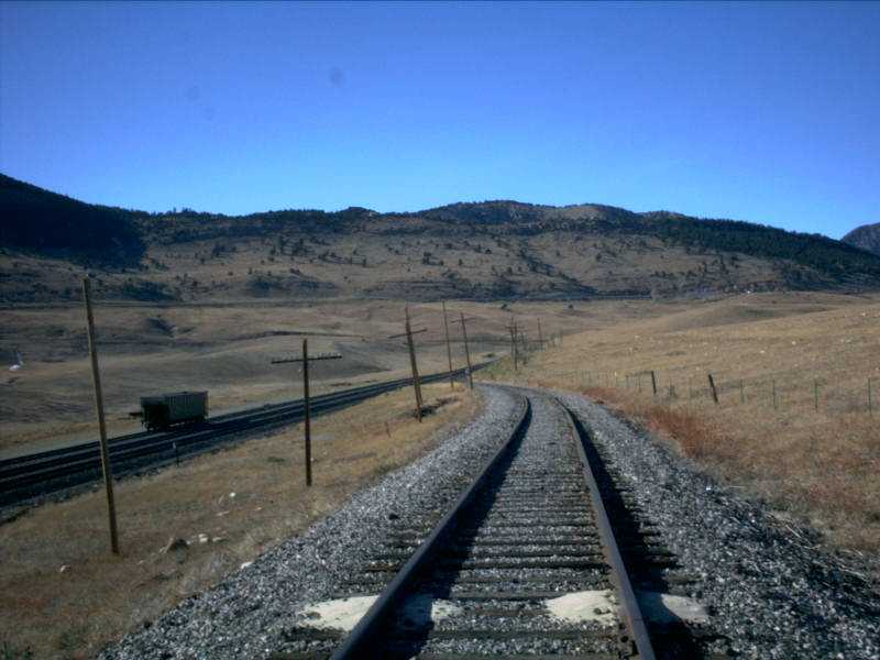
One of the unique features of Rocky that is different from most (but by nomeans all) of the sidings on Rio Grande's system is that there is a spur that branchesoff from the mainline. This is the Rocky Flats Industrial Lead or "AEC Spur". Thespur services both Rocky Flats and TXI Industries. Due to the layout of the land, thespur had to be built leaving the mainline heading east. This of course meant thatwestbounds either had to run around their train on the siding, or back into the spur.Likewise, they would have to back out of the spur onto the mainline, or run aroundtheir train again.
Picture 5
The spur does not have a particularly appealing grade! Even with a very few cars,it can be a bit difficult to get up the 5% plus grade. For reference, you can seedowntown Denver off to the right side of the picture, as well as the mainline andsiding.
Picture 6
This picture shows a little bit better the challenge presented by the spur as itclimbs away from the mainline at Rocky. This would not be a good place to break adrawbar or a knuckle, as there would be very little to prevent a car from rolling,rather quickly, back down to the mainline...
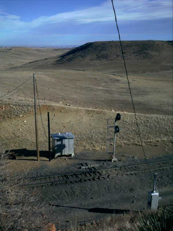
Picture 7
...However, if a car were to roll back down toward the mainline, the derail switchwould catch it, much like the derails on the house tracks and sidings. In this picture,we see the extremely short switch that leaves the mainline and heads east and verymuch up toward highway 93.
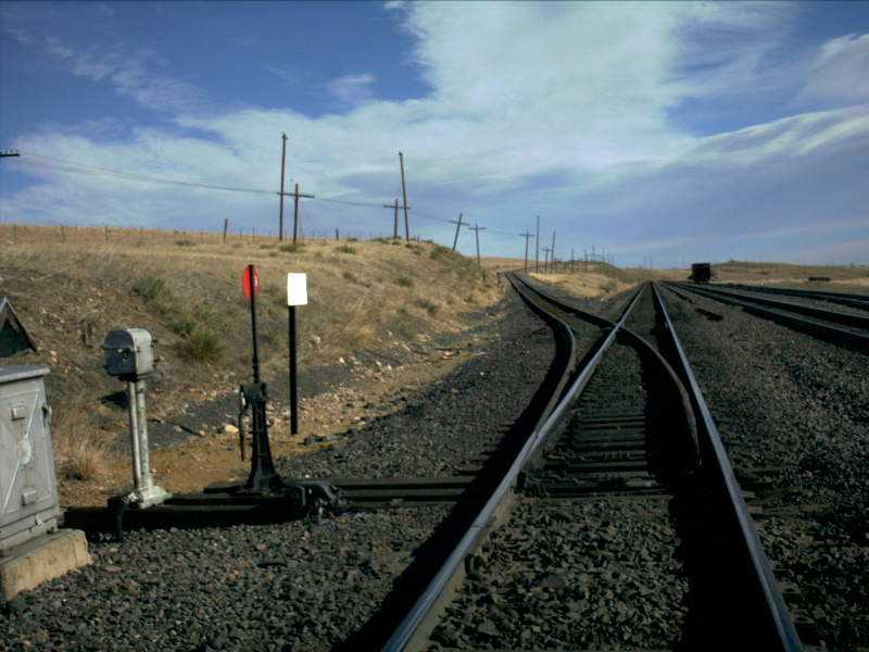
Also like at Leyden, Rocky has a house track that can be used for settingout bad order cars, or for temporary storage of surplus cars or machines and equipment.The house track is roughly one third of the way into the siding when heading westbound.The house track is about 1,200 feet in length and the west switch of the house tracklines up almost perfectly with the switch to the Rocky Flats Industrial Lead.
Picture 8
As mentioned above, the house track can be used for setting out bad order cars.That was the case on this Saturday afternoon, as a sole hopper loaded with coal sitsby itself on the house track at Rocky. It turns out that this particular car wasset out because it has some extremely bad flat spots on the wheels, which can damagethe track as well as increase the risk for derailments. This car was picked up laterin the day and taken to North Yard to get new wheels.
Picture 9
This is another one of those somewhat "busy" pictures, taken with an eyeline almostthat of the top of the rails. On the left side of the picture is the switch stand andbox for the Rocky Flats Industrial Lead which goes up the hill. In the foreground ofthe picture, running along the ground and connecting in with the siding is the barto throwing the west switch of the house track.
After the straight section of track, you hit Little Ten curve. It was rightat the east end of Little Ten where Rocky once came to an end. But, as mentioned,it was extended all the way through Little Ten and a good distance up torward Big Ten,adding a couple thousand feet to the overall length of the siding. It is amazing toimagine what the terrain must have looked like when the engineers came through here,before even the fills were there!
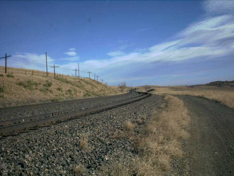
Picture 10
This shot is a nice reverse shot of Picture 4 above. This looks back east and againyou can clearly see the change in grade. The small black dot to the right of the tracksis the hopper sitting on the house track!
Picture 11
Here is Little Ten curve, the first of two curves so named because they have aten degree radius all the way through the curve. The tracks curve way off to the righthere, but then swing around to the left and the glare from the siding can be seen deadahead. If you look up from the right end of the glare, you can see a small white box onthe mountain side. This is the box at the radio tower at Clay, the next siding to thewest. If you move to the right of the picture on a horizontal line from the white box,you can see yet another, smaller, silvery-white box. This is the shed at the west endof Clay. By rail, it is still nearly three miles away!
Picture 12
Little Ten curves in its entirety. Picture 11 was taken about two hundred feet eastof the glare at the right side of the picture. As the tracks come out of Little Ten,they hit another straight section of track where the grade starts to kick in and theclimb toward the west end of Rocky, and Big Ten, really start.
The west end of the siding actually has the tracks running almost due south(geographical) when heading west (trackwise). In the time a train runs from east Rockyto east Clay, the train will hit all 360 degrees on the compass, starting west, thencurving south out of Rocky, east around Big Ten and finally north through the sidingat Clay. The west end of the siding is located in a cut and although it is not apparent,the signals at the west end do not directly face the track, but more toward the eastend of Little Ten, so an oncoming westbound has some advanced notice of the conditionof the signals.
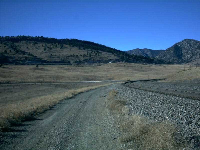
Picture 13
The west end of the siding is on a nice grade climbing toward Big Ten curve. Thedwarf at the west end is not exactly a dwarf...more like a compromise between a standardsignal and a dwarf. It must be slightly taller than a typical dwarf in order to beseen over the east end of the cut.
Picture 14
The (trackwise) north side of the cut at the west end of Rocky is a pretty significantdistance above the tracks, and makes the signal stand and tracks look almost model-likein this picture. The huge hill in the background is actually Big Ten curve. If you lookjust below the horizon on the left side of the picture, you can see what looks like a blackhorizontal rectangle. This is actually the shadow from the bridge for CO 93 running overthe tracks. This is basically the east end of Rocky.

Picture 15
And here we have the west end of Rocky looking east. The cut on the left side of thepicture is the vantage point for the previous picture. If you look at the signal shed, youcan see a broom resting against the side. Brooms are often found at the ends of sidings asthey have many applications, not the least of which is helping to clear snow if the needarises. From here, the next siding west is Clay, only two miles up the track.
ROCKY STATISTICS
EAST SIGNALS
WEST SIGNALS
Date Added: 1/21/2001
Subdivision.. Moffat Tunnel
Milepost..... 18
Length....... 7,330 feet
Speed........ 35-30
Dispatcher... DS-82
AAR.......... 23 (160.455)
House Track.. Yes -- Approx 1,200 feet
Branches..... Rocky Flats Industrial Lead
Grade Xing... One private crossing (Railroad Property)
Access Road.. Yes, Full Length (Private Property, Railroad Use Only)
Westbound......... Always On
Eastbound Main.... Approach Lit
Eastbound Siding.. Always On
Eastbound......... Always On
Westbound Main.... Always On
Westbound Siding.. Always On
Last Data Update:
Last Picture Update:
|
|
Check out ColoradoRailfan.com on Facebook |
|
|
Check out the latest ColoradoRailfan.com photos on Flickr |
|
|
|
||||||