

|
|
|
| West to Crescent |
The Siding of Plain marks the beginning of the Tunnel District. When heading westbound, Plain is the last siding that trains will see until Crescent, which means passing through 16 tunnels along the Front Range and up through South Boulder Canyon above the small town of Eldorado Springs. Those 16 tunnels come in only six miles! Plain is short for Plainview, which is a very appropriate name as you can see in the following pictures.
Plain is easily accessible via a dirt road off of Colorado Highway 72. From the intersection of CO Hwy 93 and CO Hwy 72 (near Plain), proceed west on Hwy 72 toward the mountains. Shortly before reaching the throat of the canyon, there will be an opportunity to turn left or right. Turning left takes you to the Blue Mountain road crossing, another popular spot for photographers and railfans. Turning right takes you up the dirt road to Plain. There are few places to park at Plain without trespassing (which you should NEVER do), but you can sit in your car near the tracks without trespassing and enjoy the view and the action. Many people park down the road a ways and hike up to the tracks. The grade crossing at Plain falls closer to the east than the west end. The east end of the siding can be viewed from the crossing.
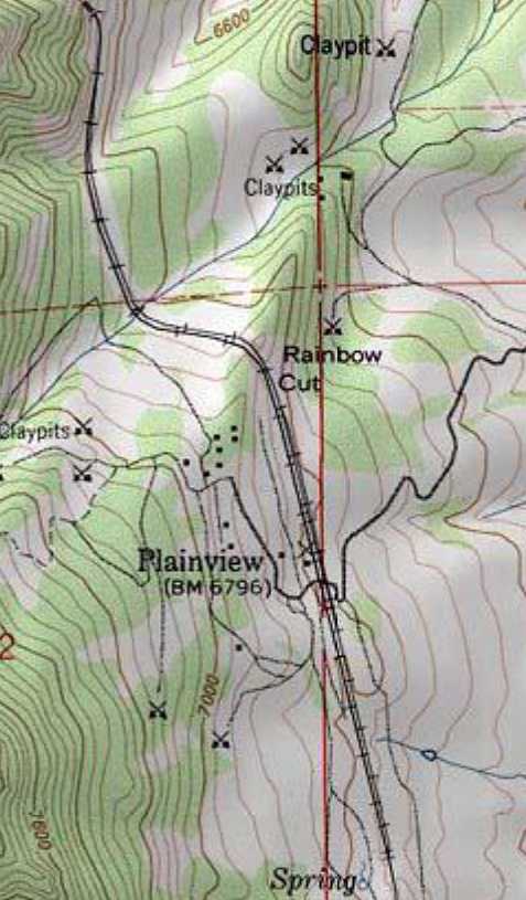
Here is the topographical representation of the area of Plain. As you can see, Plain
runs nearly (geographic) north-south, not east-west. This begins the section of track where
trains run along the Front Range (notice the east end of tunnel two at the top of the map)
before running through the curved tunnel eight, which sends the tracks west into the Rocky
Mountains.
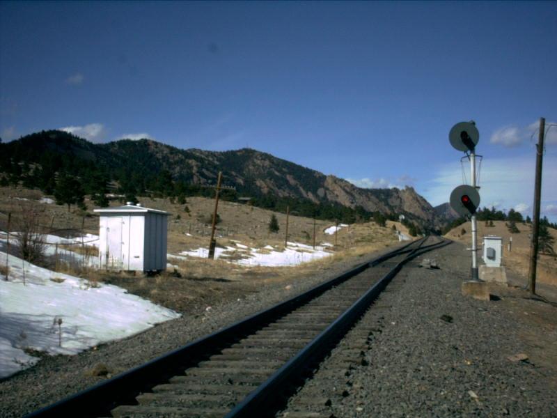
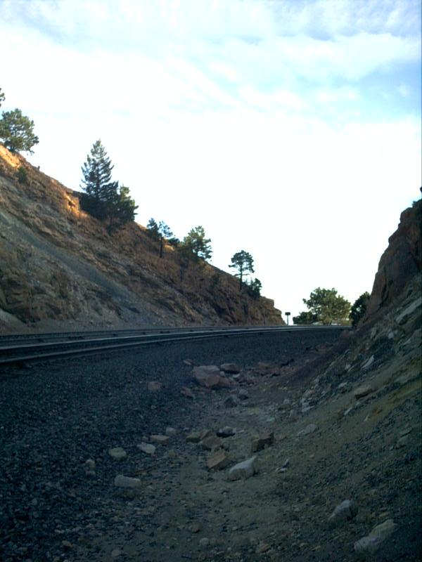
Picture 1
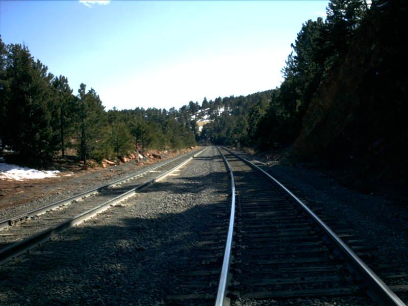
When entering the east end of Plain heading west, one can clearly see the grade change
at the siding. The tracks disappear over a slight grade in a cut in this picture. Just
beyond the cut is the grade crossing and the house track. Beyond that, on the same
straight away is Rainbow Cut and a wonderful S-curve.
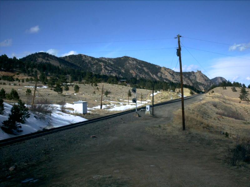
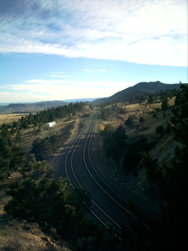
Picture 2
It is here at the east end of Plain where the last feeling of the open
plains exists. From Rainbow Cut and on west, you are isolated in the middle of the Rocky
Mountains. Not good if you are claustrophobic!
Picture 3
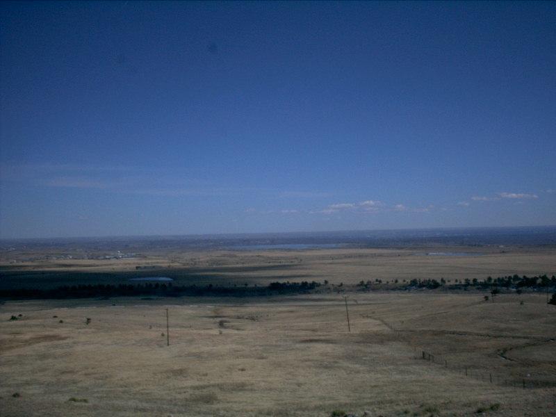
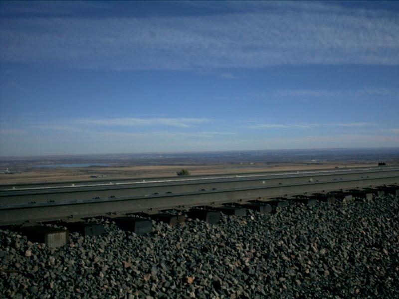
So just where does Plain (short for Plainview) get its name? I suspect that this
picture is probably worth a thousand words of explanation! Notice the clouds of a
temperate, lazy, March afternoon hanging out over the plains. Notice the lake near the
middle of the picture, close to the horizon. This lake is Stanley Lake, located in
Arvada and Westminster. You may have to zoom in, but along the left side of the picture,
again near the horizon, you might notice an industry with a white water tower. This is
Rocky Flats!
Picture 4
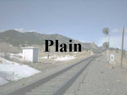
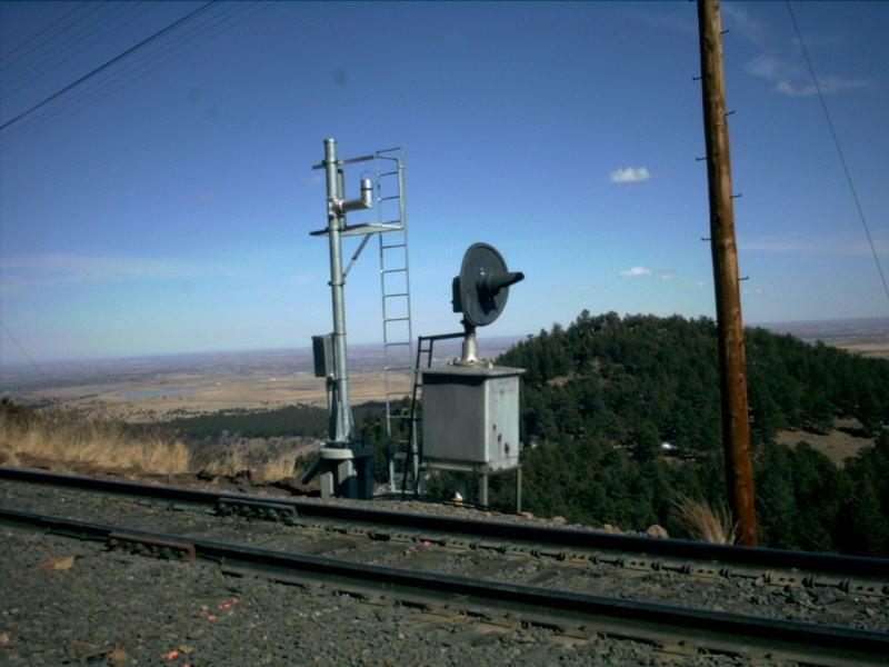
Here is a great picture of the signals protecting the east switch at Plain. The
picture is looking track east, toward tunnel one. The mountain seen over the hill
in the background is Blue Mountain. Notice the height difference between the signal
on the main and the dwarf of the siding. The dwarf signal lives up to its name here
as it sits right on the ground!
Like the two sidings before it, Plain too has a house track. While Leyden is often used for temporary storage of cars, the house track at Plain frequently has Maintenance of Way equipment tied down on it. There are also several green maintenance sheds that house miscellaneous equipment. Alongside the house track, all sorts of heavy equipment including rails and ties can often be seen.
Picture 5
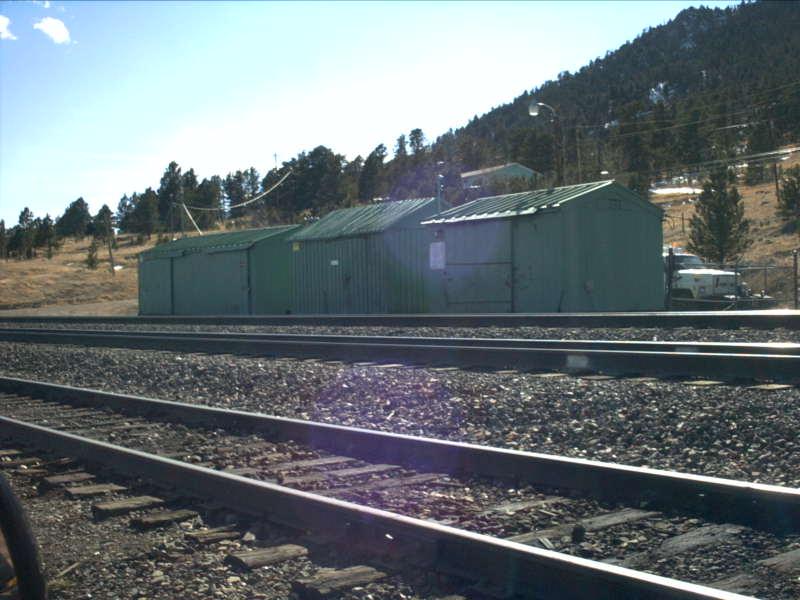
The east switch of the house track is just east of the grade crossing. When entering
the house track, it hits a depression to try to keep any rolling stock that might be tied
on the house track to stay there! The three green maintenance sheds can be seen in this
picture.
Picture 6
Anybody looking to model the equipment sheds? Here they are! In the days of the Rio
Grande, "speeders" were stored in the sheds and tracks came out of the sheds and intersected
with the main and siding at 90 degree angles. The speeders could be dragged out of the
sheds and rotated on to the appropriate track. Today, highrailers have replaced the
speeders...one such highrailer can be seen sticking out from behind the maintenance sheds
to the right.
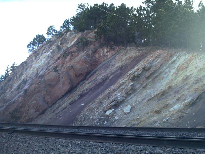
Continuing west through the siding, there is another brief period where the open plains can be clearly seen. Then, the infamous Rainbow Cut is hit! Like Plainview, Rainbow Cut has a very justifiable name. When the cut was created those many years ago, the inside of the rock was discovered to have several different types of rock within it. I don't claim to be a geologist, so I don't know the types, but the color variations give the cut the look of a rainbow!
Picture 7
Here is a second look at the view of the plains from Plainview. The track in the
foreground in the mainline. Stanley Lake is again visible, this time on the left side
of the picture. Downtown Denver is very hard to make out in this picture, but not
impossible. If you zoom in on the center of the picture, downtown is just off to the
right of the center.
Picture 8
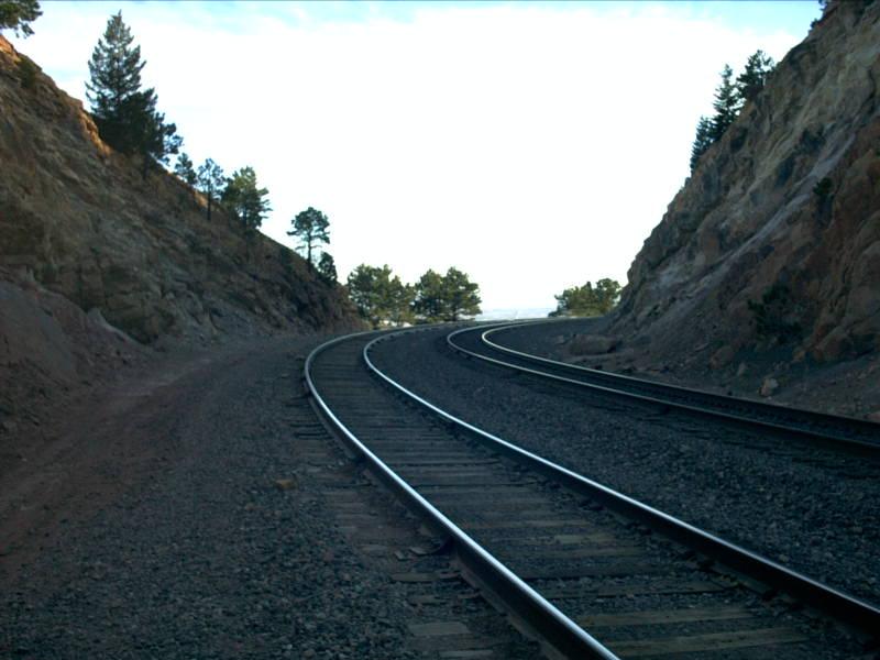
Rainbow Cut! This is the east end of the cut, looking east. The siding is the
track on the left, the main on the right. If you were to follow out the remainder of this
curve, you would be on the straight away heading for the grade crossing.
Picture 9
Why is it called Rainbow Cut? This is exactly why! Everyone has a different
perception of colors, but my eyes can see red, orange, yellow, blue and purple just in
this one picture. This is the cut on the (track-wise) south side of the tracks...
Picture 10
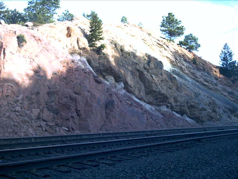
...and here is the cut on the (track-wise) north side of the tracks.
Picture 11
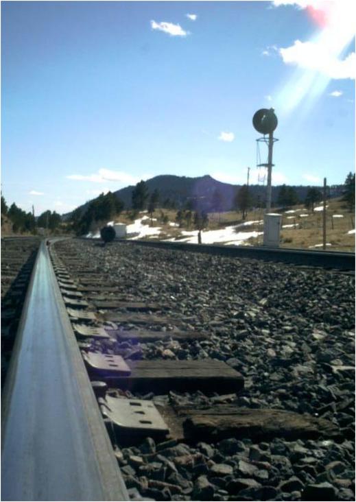
As one might expect, one of the largest potential danger of mountain railroading
can be rocks on the tracks! In the high-danger areas of the Moffat, the tracks are now
protected by slide-detector fences. If a rock breaks a wire on the fence, signals are
automatically set to red, protecting the potential danger, and the dispatcher is immediately
notified. Here, a few rocks -- not large enough to be any threat -- lie on the ground
alongside the mainline.
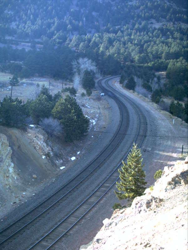
So one might wonder what the view from on top of Rainbow Cut looks like! From atop the cut, you can see down the straight away of the tracks toward the east end of the siding, or you can look to the west end of the siding and see tunnels 2 through 4. There is also no better place for viewing the S-curve that snakes through the cut!
Picture 12
It is getting to be late in the afternoon on this Friday in February, but there is
still enough sunlight to produce some nice shadows. This picture is looking track-wise
east, although it is really closer to geographic south. The house track can be seen
leaving the siding, and MOW equipment can be seen tied down on it.
Picture 13
Here is the S-curve mentioned before. Unfortunately, there are many trees in the
area that are tall enough to effect, at least to some extent, almost any picture! Regardless,
this picture is taken looking the opposite direction from Picture 12 above. The mainline
is on the left, and runs through a greaser on the (short) straight portion of the S-curve.
Picture 14
What a wonderful place from which to get a glance at the beginning of the tunnel
district! Notice the white box toward the left of the picture. This is the control box
at the west end of Plain. Just right of the control box is the mouth to the east end of
tunnel two. Following a line that is not quite horizontal from tunnel two, you can make
out the east portals to tunnel three and tunnel four.
We now start to head for the west end of Plain. The west end of the siding gives the impression of being hidden away in the mountains much more than the east end of the siding does. Union Pacific appears to be in the process of replacing the communication methods along the Moffat Road. Southern Pacific added fiber optics to the line during the 1990s, but it appears that Union Pacific may be moving to microwave. Radio towers are going up at many sidings and new signals are being installed!
Picture 15
There is a section of Plain that is well-concealed by trees and hills, towards the
west end. This picture shows that section of track. The picture is looking track-wise
east. The tracks curve off to the left, which marks the beginning of the S-curve that
is seen so well from atop Rainbow Cut.

Picture 16
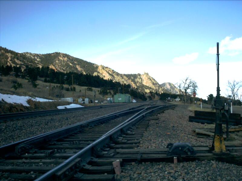
Here is the west end of the siding. After the concealed straight away seen in picture 15
above, the tracks go around a relatively gentle curve to the right before the siding
converges back in with the mainline. The signal for the mainline has rusted
quite a bit and blends well with the red rock, but can be seen towards the left
of the picture. The dwarf, on the other had, is well contrasted with the blue
sky at the right of the picture.
Picture 17
As mentioned before, Union Pacific is replacing some of the older Rio Grande signals
with newer signals. The west end of Plain is a prime example of this. Here, the new
signal stand for the dwarf can be seen just behind the existing dwarf. A big question
is what kind of signal will this mean? Single searchlight or three searchlight?
Picture 18
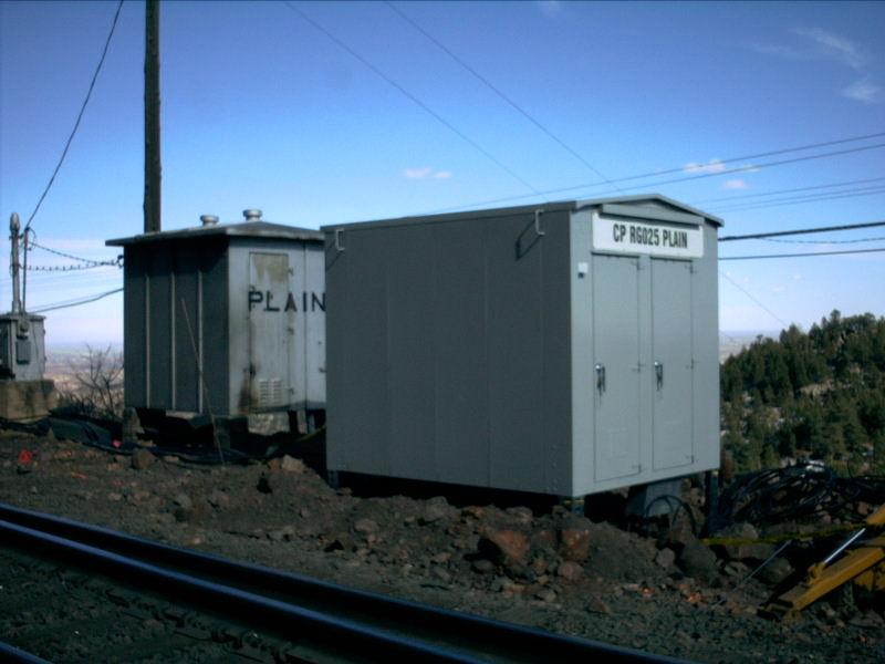
To facilitate the new signals and the new radio tower, a newer, slightly larger
control box is being put in at the west end of Plain. One thing of interest is that there
is now a Control Point at the west end of the siding. The Control Point can be seen on
the new box as "CP RG025 PLAIN". The RG must stand for Rio Grande, which is a good thing!!
The 025 represents the milepost...25 miles from Denver.
Picture 19
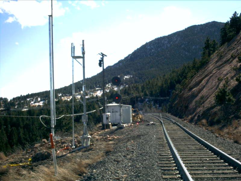
Finally, to wrap up this tour of Plain, is the signal at the west end of the siding,
looking east. The pole at the left of the picture which leaves the view of the camera at
the top is the new radio tower. To the right of that is the new signal tower, without
any searchlights added yet.
PLAIN STATISTICS
EAST SIGNALS
WEST SIGNALS
Subdivision.. Moffat Tunnel
Milepost..... 24.5
Length....... 6,530 feet
Speed........ 28-25
Dispatcher... UP 82, Omaha
Frequency.... 160.455 (repeater: 452.900)
House Track.. Yes -- Approx 1,500 feet
Branches..... None
Grade Xing... One -- Dirt Road, Railroad Access Road
Access Road.. Yes, Full Length (Private Property, Railroad Use Only)
Westbound......... Always On
Eastbound Main.... Approach Lit
Eastbound Siding.. Approach Lit
Eastbound......... Always On
Westbound Main.... Always On
Westbound Siding.. Always On