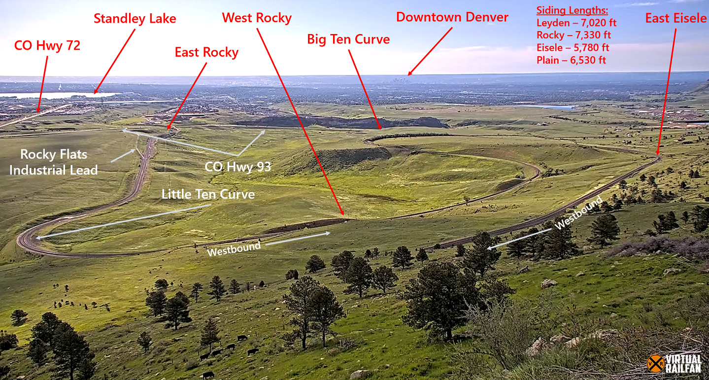
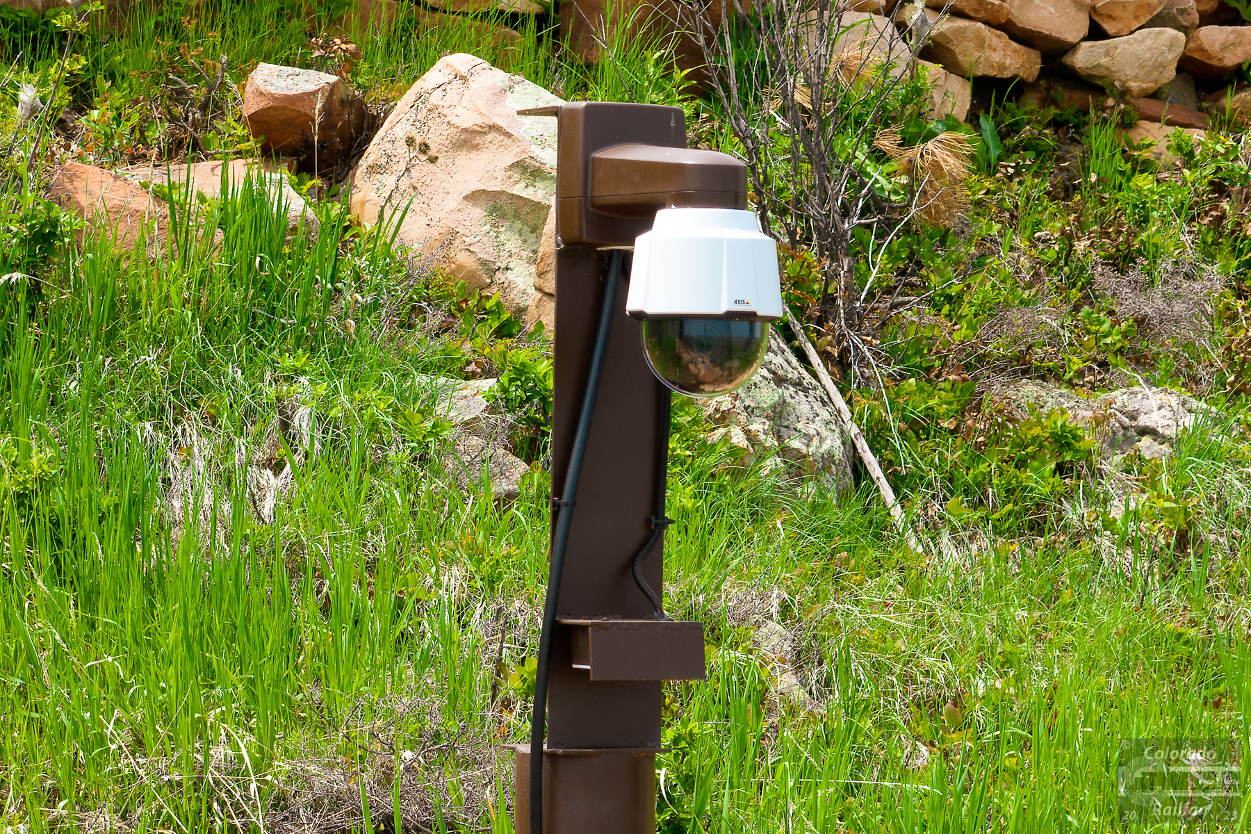
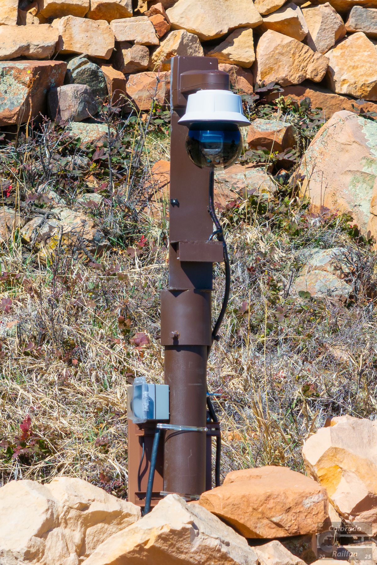
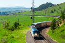
Did you know that Virtual Railfan now has a LIVE webcam positioned to view Big Ten Curve and the surrounding area? Go to their website and sign up for a subscription, or check out the feed on YouTube. When you check out the view, you are looking from the west on the hillside toward Denver. Here is a general key of what you are seeing in the "standard" (wide) view. Note that there is a camera operator, so the camera can pan, tilt, and zoom.
Quick Facts Big Ten Curve (and the Virtual Railfan camera) are located approximately 15 miles (as the crow flies) west northwest of Union Station in downtown Denver. Along the rails, Big Ten Curve lies approximately 19 1/2 miles west of Union Station. The Virtual Railfan camera is near MP 21.3, above the tracks. The tracks are owned by Union Pacific on the Moffat Tunnel Subdivision. The track is single track CTC/PTC with periodic passing sidings. There are four passing sidings in the first 25 miles of track west of Denver:
Leyden - MP 11.9 to MP 13.4 (7,020 feet long) - Can accomodate roughly 115 cars and 6 engines
Rocky - MP 17.4 to MP 19.0 (7,330 feet long) - Can accomodate roughly 120 cars and 6 engines
Eisele - MP 20.6 to MP 21.8 (5,780 feet long) - Can accomodate roughly 90 cars and 6 engines
Plain - MP 23.9 to MP 25.4 (6,530 feet long) - Can accomodate roughly 105 cars and 6 engines
Rocky and Eisele are both visible from the camera when it is in its standard "wide angle" view. Leyden is visible when the camera zooms it to its maximum capability. Plain is not visible from the camera.
Radio Frequencies If you live in the Denver area and are interesting in listening to conversations between railroad crews and the dispatcher, or in trying to pick up readouts from hot box detectors, you need to have a radio scanner capable of scanning the FM band between 159.810 MHz and 161.565 MHz. For the Moffat specifically, the frequency from Denver to East Rocky is 160.320 MHz. At East Rocky, there is a channel change. From East Rocky west up to the Moffat Tunnel, the frequency is 160.455 MHz.
Traffic Levels
As of mid-2023, the line sees, on average, six trains in a 24 hour period, with various combinations of the following trains:
Daily: Westbound California Zephyr (#5) - Around 8:45am when on time
Daily: Eastbound California Zephyr (#6) - Around 5:30pm when on time
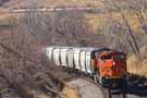
Nearly Daily: Westbound BNSF HDENPVO (Manifest from Denver, CO to Provo, UT) - Time can vary
Nearly Daily: Eastbound BNSF HPVODEN (Manifest from Provo, UT to Denver, CO) - Time can vary
Three times a week: Westbound UP MNYGJ (Manifest from Denver, CO to Grand Junction, CO) - Time can vary, but usually in the late evening, generally after dark
Three times a week: Eastbound UP MGJNY (Manifest from Grand Junction, CO to Denver, CO) - Time can vary, but usually in the early morning, often before sunrise
Sunday/Wednesday (April through October): Westbound Rocky Mountaineer passenger train - Around 9:40am when on time
Tuesday/Friday (April through October): Eastbound Rocky Moutaineer passenger train - Around 5:00pm when on time
Friday-Sunday (January through March): Amtrak's Westbound Winter Park Express Ski Train - Around 7:45am when on time
Friday-Sunday (January through March): Amtrak's Eastbound Winter Park Express Ski Train - Around 5:30pm when on time
Random: UP or BNSF oil trains (empty westbound / loaded eastbound)
Random: UP or BNSF frac sand trains (loaded westbound / empty eastbound - unit covered hopper train)
Random: UP or BNSF coal trains
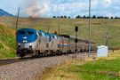
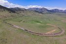
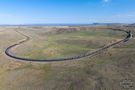
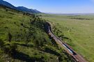
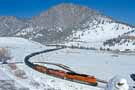
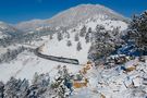
Brief History and Overview Union Pacific's Big Ten Curve (also sometimes referred to as Big Ten Loop) is an amazing piece of railroad engineering designed to allow trains headed west from the plains of Denver to climb in to the Colorado Rockies with as minimal a grade as possible. When the line was originally being built, the tracks needed to gain roughly 300 feet of elevation, but the direct route was only 3,300 feet in distance. This would have necessitated a grade of roughly 9%, which is essentially impossible for a mainline railroad. Even 3% is considered exceptionally steep. In order to keep the grade to 2% or less, architects of the railroad found a route that, instead of 3,300 feet in distance was about 3 miles, or roughly 16,500 feet in distance! This reduced the average grade of the tracks from 9% to 1.8%.
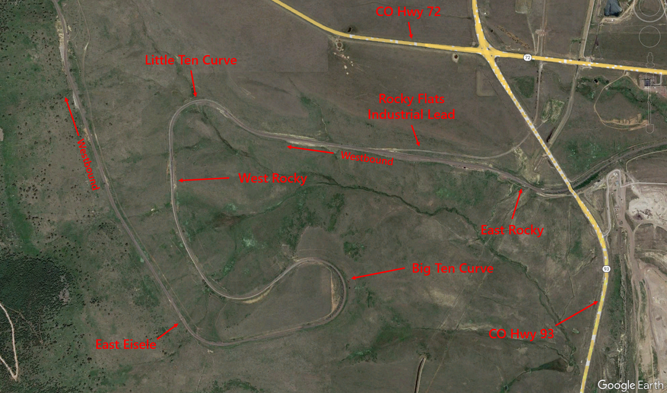
In order to cover that 3 miles in 3,300 feet (as the bird flies), the tracks wrap through several 10° curves. In railroad terms, the degree of curve is defined as how many degrees the tracks curve away from a certain point after 100 feet of distance over the rails. So, over the course of 100 feet of rail, the tracks curve 10° away from the starting point. There are two main curves that were created that both have 10° to them. The first, known as Little Ten Curve, take trains that are headed geographically west and ends up with them heading geographically south. The second (and larger) curve is Big Ten Curve. It takes train heading geographically east and wraps them around to end up heading geographically north!
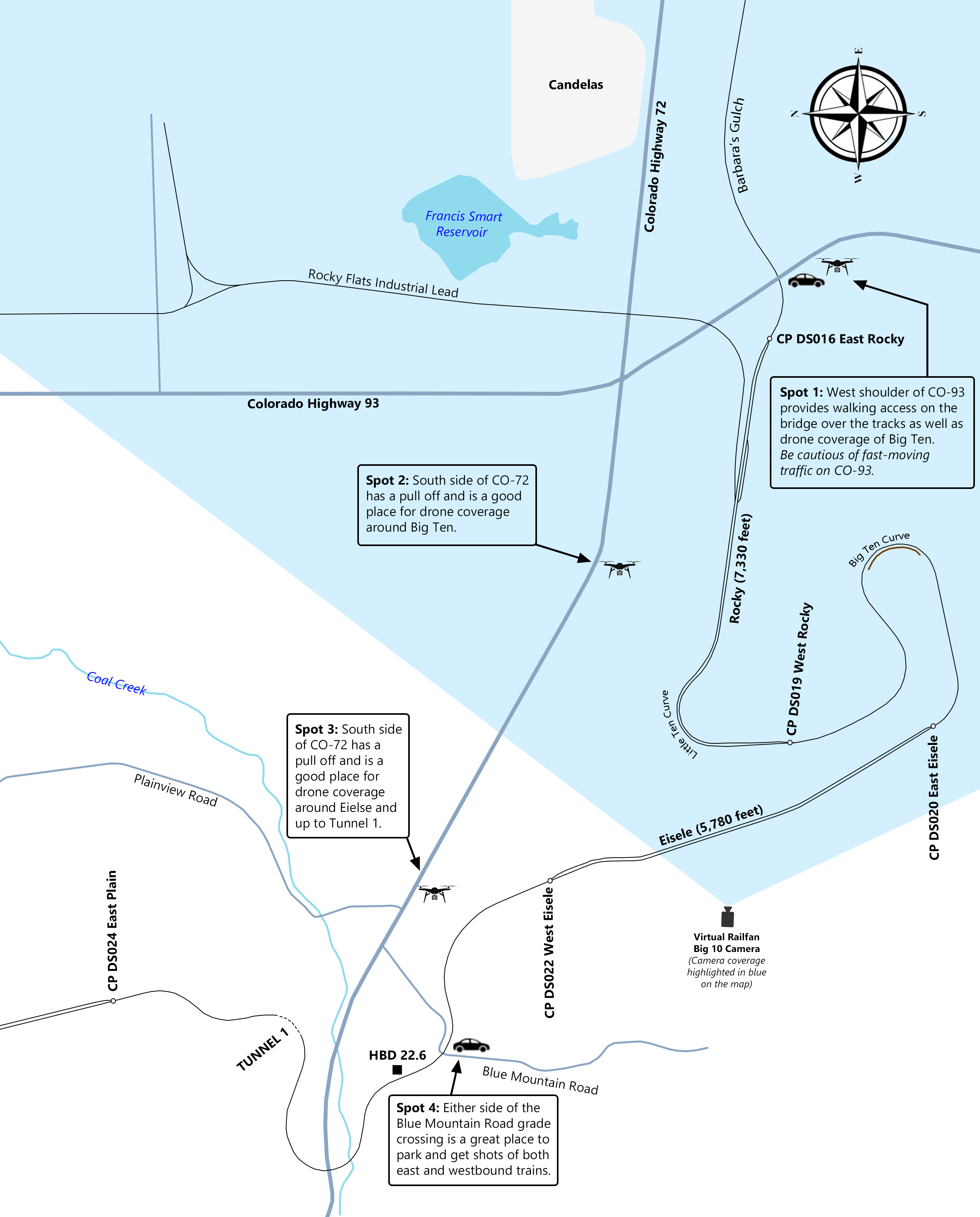
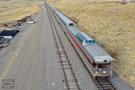
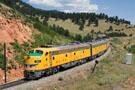
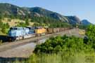
Barbara's Gulch, CO Hwy 93, and Rocky Before we get to Big Ten, we will start a little bit east at Barbara's Gulch. This gulch narrows as the tracks approach the CO Hwy 93 underpass. Train emerge from the underpass and come around the curve on the approach to East Rocky. The siding at Rocky is 7,330 feet long. However, when it was originally constructed, it is was 4,900 feet long. The Denver and Rio Grande Western had a general policy of "short, fast" trains, meaning long sidings were generally not needed. However, as coal became more and more common in the 1970s and 1980s, the siding was lengthed (to the west) to its current length. The siding has a "house track", located approximately halfway through the siding. A house track is a short track that can be used for setting out bad order cars, or for temporary storage of maintenance or other equipment.
Amtrak passes under CO-93 at the west end of Barbara's Gulch.
Click on the thumbnail image above for a larger image and more detailed caption.
Westbound BNSF manifest passes the West Local at Rocky.
Click on the thumbnail image above for a larger image and more detailed caption.
Westbound Amtrak on the main at Rocky.
Click on the thumbnail image above for a larger image and more detailed caption.
Westbound Zephyr departing the west end of Rocky.
Click on the thumbnail image above for a larger image and more detailed caption.
Rocky Flats Industrial Lead
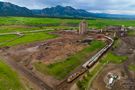
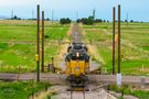
Also located at Rocky is the branch line to the Rocky Flats Industrial Lead (sometimes just called the Rocky Spur). This is a 4-mile-long spur track that departs the main to the east, climbing up a massive 8% grade. The 8% grade is not very long, and the trains that run on the spur are "locals" that typically consist of two engines and just a handful of cars. The spur track crosses both CO-93 and CO-72 at grade crossing and runs north to an aggregate plant. This is the only remaining industry active on the spur. UP's West Local runs on Wednesdays (although not every Wednesday...seems to average every third Wednesday), usually in the afternoon, out to the plant. There is a wye on the spur that allows trains to turn around on the return trip to the mainline. Both CO-72 and CO-93 have stop lights protecting the grade crossing instead of traditional crossing signals/gates. When the train approaches the crossing, a circuit is tripped that changes the stoplight yellow, then red. There is also a stoplight pointing toward the rails for the train. It will changes from two reds to two greens once the stoplight for traffic is red. Once the train clears the circuit, the light returns to red for the tracks and green for cars.
The West Local returns to the mainline.
Click on the thumbnail image above for a larger image and more detailed caption.
The West Local, with just two engines, crosses CO Hwy 93.
Click on the thumbnail image above for a larger image and more detailed caption.
The aggregate plant at the north end of the spur.
Click on the thumbnail image above for a larger image and more detailed caption.
Approaching CO-72 with a red light for the train.
Click on the thumbnail image above for a larger image and more detailed caption.
Light has changed green for the train to cross CO-72.
Click on the thumbnail image above for a larger image and more detailed caption.
Big Ten and Little Ten Curves As mentioned in the brief history section above, Little Ten and Big Ten Curves got their name from the fact that the track has 10° of curvature through the curves. So the track deflects 10° for every 100 feet of lateral movement. It is the combination of these curves climbing the terrain that allow the tracks to have an average grade of 1.8%.
And eastbound BNSF manifest enters Big Ten Curve.
Click on the thumbnail image above for a larger image and more detailed caption.
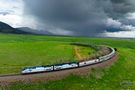
The Zephyr curves around Big Ten Curve.
Click on the thumbnail image above for a larger image and more detailed caption.
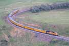
Eastbound oil train on the main at Rocky, running through Little Ten Curve.
Click on the thumbnail image above for a larger image and more detailed caption.
UP passenger special just east of the open hoppers.
Click on the thumbnail image above for a larger image and more detailed caption.
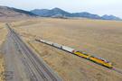
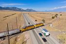
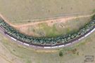
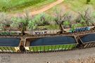
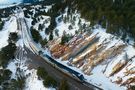
Hopper Car Wind Break One of the most fascinating features of Big Ten Curve specifically are the open hoppers located on the inside of the curve. Winds coming down off the front range of the Rockies can be as high as 90 MPH and, in at least two instances in the past, empty trains going around Big Ten Curve were literally blown right off the rails, causing a derailment. The Denver and Rio Grande Western Railroad (the railroad that owned the tracks at the time) came up with a unique solution. They built a track on the inside of the curve, place a string of open top hoppers on that track on the inside of the curve, and severed the inside track, isolating it. A few of the hopper cars wheels were then welded to the track. The hoppers were filled with concrete and dirt and surrounded by rocks. This created a permanent wind break! The wind hits the hoppers and flows over the top, protecting trains on the curve.
Top-down view of a train passed by the wind break.
Click on the thumbnail image above for a larger image and more detailed caption.
Eastbound passing by the wind break hoppers.
Click on the thumbnail image above for a larger image and more detailed caption.
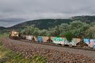
A westbound sand train in Barbara's Gulch. You can see the hoppers on Big Ten Curve in the distance.
Click on the thumbnail image above for a larger image and more detailed caption.
Another (closer) view of one of the hoppers serving as a wind break.
Click on the thumbnail image above for a larger image and more detailed caption.
It has been difficult finding the exact date when the hoppers were installed, but it appears to be sometime in 1972. They were not present in November 1971 (when the last train was blown off the tracks), but were in place by early 1973. The hoppers appear to have been built in 1952 as part of a run of hoppers numbered from 18500 to 18999. Numbers on two of the cars were identified in the past as being DRGW 18532 and DRGW 18711. Assuming the 1952 run is correct, they were built by Pressed Steel Car company and weighed 154,000 pounds (empty). Prior to their permanent home, they were mainly used on ballast trains and maintenance work.
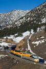
Eisele, Blue Mountain, Tunnel 1, and Plain After making it through Big Ten Curve, westbounds come up to the siding of Eisele. Until 2013, this siding was named Clay (and before that, Fireclay). The name Clay (or Fireclay) comes from the type of soil/clay found throughout the area around Big Ten. In 2013, a senior Union Pacific official (Charlie Eisele, V.P. of Strategic Planning) retired. In honor of him, Union Pacific chose to rename Clay to Eisele. The name change went in to effect at 10:15am on April 2, 2013. Meets between two trains are somewhat rare at Eisele for a couple of reasons. First, at 5,780 feet, it is not long enough to accomodate meets between some longer trains. Second, and perhaps more relevant, the siding has weight restrictions on it. As mentioned, the original name of Clay comes from the soil in the area, which tends to be soft. With the siding closer to the end of the hill, heavy trains (such as loaded coal trains, oil trains, and many manifests) cannot use the siding. Unlike Rocky, Eisele does not have a house track.
The westbound Ski Train rolls west on the main.
Click on the thumbnail image above for a larger image and more detailed caption.
A rare meet with the westbound Zephyr in the siding and an oil train on the main.
Click on the thumbnail image above for a larger image and more detailed caption.
The eastbound Zephyr ont he main at Eisele.
Click on the thumbnail image above for a larger image and more detailed caption.
An eastbound oil train at East Eisele.
Click on the thumbnail image above for a larger image and more detailed caption.
Continues west from Eisele is Blue Mountain Road Crossing. This is a various famous spot for pictures on the Moffat along the front range. There are some fabulous curves, in particular to the west, that lend for some very nice shots. Railfans can also observe eastbound trains exiting from Tunnel 1.
Eastbound oil train at the Blue Mountain grade crossing.
Click on the thumbnail image above for a larger image and more detailed caption.
Eastbound manifest at the Blue Mountain grade crossing.
Click on the thumbnail image above for a larger image and more detailed caption.
The eastbound Rocky Mountaineer at Blue Mountain grade crossing.
Click on the thumbnail image above for a larger image and more detailed caption.
Tunnel 1 is the first tunnel west of Denver...the first of 28 between Denver and the Moffat Tunnel! At 366 feet long, the tunnel is not particularly long, but it is a good indicator that the Tunnel District is not far ahead. One rather unique characterstic about the tunnel is that the west portal of the tunnel is actually east of the east portal! When westbound approach the east portal, the trains are actually heading geographically east! When exiting the tunnel, they are moving roughly geographically north. Just another part of the curves in the area on the climb up the Rockies.
UP 1989 leads the westbound Ski Train toward Tunnel 1.
Click on the thumbnail image above for a larger image and more detailed caption.
UP E-Units lead a passenger train toward the west portal of Tunnel 1.
Click on the thumbnail image above for a larger image and more detailed caption.
The westbound Zephyr approaches Tunnel 1.
Click on the thumbnail image above for a larger image and more detailed caption.
Overview of Tunnel 1.
Click on the thumbnail image above for a larger image and more detailed caption.
The last thing we will discuss here is the siding of Plain. With meets rarely occuring at Eisele, it is more common for either Rocky or Plain to be used for meets with trains in the area. Similar to Rocky, Plain has a house track for setting out cars or temporary storage of maintenance equipment. Union Pacific also has several maintenance buildings located at Plain, and Plain tends to be the "headquarters" for maintenance personnel heading west in to the Tunnel District. One of the highlights of Plain is Rainbow Cut, which is so-named due to the incredible colors that can be found in the rock. The colors range from red, to yellow, to purple.
The westbound Zephyr at Rainbow Cut.
Click on the thumbnail image above for a larger image and more detailed caption.
UP 1982 leads an eastbound coal train at Plain.
Click on the thumbnail image above for a larger image and more detailed caption.
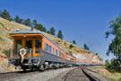
Former DRGW cars California and Kansas on the back of the Zephyr at Plain.
Click on the thumbnail image above for a larger image and more detailed caption.
Green signal for an approaching eastbound at East Plain.
Click on the thumbnail image above for a larger image and more detailed caption.
Railroad Terminology If you are new to railroading, there are some terms you may not be familiar with. This section will cover a few of the terms you might hear (or read about in YouTube comments)!
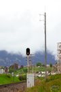
CTC (Centralized Traffic Control) - This refers to of the types of ways trains are granted authorization to move along the rails. With CTC, there are block signals (similar to traffic lights) along the tracks that show various different color aspects (again, similar to traffic lights), informing the crew on the train what to do and/or what they can expect. Should they stop? Should they slow down? Should they go at the maximum allowed speed? The signals also help inform the crew as to which track they will be taking. Staying on the mainline, or going in to a siding? With CTC, a dispatcher (in Omaha, in the case of Union Pacific) is controlling the signals and watching the location of train on a computer display. The tracks in CTC have an occupancy indication, allowing the dispatcher to see where trains are located along the tracks.
PTC (Positive Train Control) - A relatively new system and technology that can work alongside CTC. PTC uses a combinations of radios and satellites, along with computers, to increase safety on the rails. The onboard computer on a train knows where the train is located on the earth through GPS. It also knows the condition of all the signals (when in an area using CTC, such as the Moffat Tunnel Sub). If the onboard computer detects the train is approaching a red signal and the engineer is failing to slow the train in time to stop, the computer will intercede and automatically slow the train, even bringing it to a full stop if necessary, to avoid the train accidentally running through a red signal. That is a basic overview of PTC. If you are interested in learning more, I would recommend this video from the Association of American Railroads, or this video from Union Pacific.
Block Signal - The term used to refer to the signal alongside the tracks with color indications for the train crew. Block signals are similar for trains as traffic signals are for cars.
Eastbound/Westbound - Just a simple reference to the direction of travel of a particular train. These are sometimes shortened to EB or WB. While the Moffat only runs east and west, other lines might be northbound/southbound.
A look at a CTC block signal and a PTC antenna alongside the signal.
Click on the thumbnail image above for a larger image and more detailed caption.